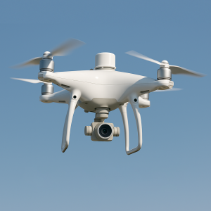
The Phantom 4 RTK is a professional drone used for aerial photography with high precision. This model is specialized for cartographic and construction projects, as it provides precise coordinates and georeferencing. Using the Phantom 4 RTK, we perform aerial photography that can be utilized to create orthophotos, 3D models, relief maps, and other necessary analyses.
WHY DO YOU NEED AERIAL PHOTOGRAPHY WITH PHANTOM 4 RTK?
- High Precision: The drone provides data accurate to centimeters.
- Fast Results Saves time and increases efficiency.
- Versatility: Used in various fields (construction, agriculture, cadastral work).
- Scalability: Capable of capturing aerial data for territories of any size.
OUR PROCESS:
Territory Planning:
We conduct an initial analysis and determine the required parameters for aerial photography.Phantom 4 RTK Drone Flight:
The drone flies along a programmed trajectory to capture high-quality photos and data.Data Processing:
Photos and data are processed using specialized software to create orthophotos, 3D models, or relief maps.Delivery of Results:
Processed files are delivered to the client in the required format (JPEG, GeoTIFF, PDF, CAD, or other).
WHAT PROJECTS CAN PHANTOM 4 RTK BE USED FOR?
- Construction Projects: Terrain analysis, topographic maps, monitoring construction progress.
- Agriculture: Analysis of landforms, elevation mapping, monitoring.
- Cadastral Work: Determining precise coordinates, planning territories.
- Geology Analysis of underground resources, building relief maps.
- Insurance: Monitoring territories, risk analysis.